File:Azerbaijan location map.svg

Size of this PNG preview of this SVG file: 512 × 392 pixels. Other resolutions: 314 × 240 pixels | 627 × 480 pixels | 1,003 × 768 pixels | 1,280 × 980 pixels | 2,560 × 1,960 pixels.
Original file (SVG file, nominally 512 × 392 pixels, file size: 156 KB)
Summary
| Description |
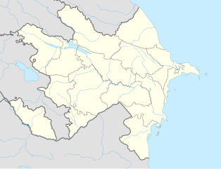
English: Location map of Azerbaijan. Borders of 1994-2020
Equirectangular projection. Strechted by 131.0%. Geographic limits of the map: * N: 42.0° N * S: 38.2° N * W: 44.5° E * E: 51.0° EMade with Natural Earth. Free vector and raster map data @ naturalearthdata.com. |
| Date | |
| Source | Own work |
| Author | Uwe Dedering, Don-kun |
| Other versions |
|


Licensing
I, the copyright holder of this work, hereby publish it under the following licenses:
This file is licensed under the Creative Commons Attribution-Share Alike 3.0 Unported license.
- You are free:
- to share – to copy, distribute and transmit the work
- to remix – to adapt the work
- Under the following conditions:
- attribution – You must give appropriate credit, provide a link to the license, and indicate if changes were made. You may do so in any reasonable manner, but not in any way that suggests the licensor endorses you or your use.
- share alike – If you remix, transform, or build upon the material, you must distribute your contributions under the same or compatible license as the original.

|
Permission is granted to copy, distribute and/or modify this document under the terms of the GNU Free Documentation License, Version 1.2 or any later version published by the Free Software Foundation; with no Invariant Sections, no Front-Cover Texts, and no Back-Cover Texts. A copy of the license is included in the section entitled GNU Free Documentation License. |
You may select the license of your choice.
File history
Click on a date/time to view the file as it appeared at that time.
| Date/Time | Thumbnail | Dimensions | User | Comment | |
|---|---|---|---|---|---|
| current | 16:48, 10 Jaenyuweri 2024 | | 512 × 392 (156 KB) | Janitoalevic | Economic Regions |
| 08:09, 5 Mieh 2016 |  | 1,200 × 919 (227 KB) | Rs4815 | Reverted to version as of 16:20, 21 April 2016 (UTC) | |
| 22:22, 3 Mieh 2016 |  | 1,200 × 919 (217 KB) | Taron Saharyan | нет достоверных данных, вы переместили границу на 1 км. чуть ли не по всей линии, это бред | |
| 16:20, 21 Ieprel 2016 |  | 1,200 × 919 (227 KB) | Don-kun | fix karabakh border | |
| 09:46, 17 Ieprel 2016 |  | 1,200 × 919 (227 KB) | Don-kun | fix border to karabakh | |
| 16:46, 13 Ieprel 2016 |  | 1,200 × 919 (217 KB) | Don-kun | Jojug Marjanli now to Azerbaijan (region seemed to be a bit wrong before ...) and tried to fix some other parts of NKR-AZ-Border | |
| 19:43, 7 Juun 2010 |  | 1,200 × 919 (217 KB) | Don-kun | correct borders of rayons; hole area under karabakh control, not the former Nagorno-Karabakh Autonomous Oblast | |
| 13:11, 19 Febyuweri 2010 |  | 1,200 × 919 (244 KB) | Uwe Dedering | Nagorno-Karabakh not grey, but visible | |
| 17:58, 18 Febyuweri 2010 |  | 1,200 × 919 (244 KB) | Uwe Dedering | but really with dagestan | |
| 17:42, 18 Febyuweri 2010 |  | 1,200 × 919 (233 KB) | Uwe Dedering | Dagestan and parts of Armenia saved from drowning, Nagorno-Karabakh now under the region-borders. |
File usage
There are no pages that use this file.
Global file usage
The following other wikis use this file:
- Usage on bn.wikipedia.org
- Usage on ckb.wikipedia.org
- Usage on de.wikipedia.org
- Usage on fy.wikipedia.org
- Usage on he.wikipedia.org