File:Location Mauritius AU Africa.svg

Size of this PNG preview of this SVG file: 646 × 600 pixels. Other resolutions: 258 × 240 pixels | 517 × 480 pixels | 827 × 768 pixels | 1,103 × 1,024 pixels | 2,206 × 2,048 pixels | 1,400 × 1,300 pixels.
Original file (SVG file, nominally 1,400 × 1,300 pixels, file size: 2.23 MB)
Summary
| Description |
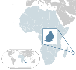
English: Map of Mauritius - an island country off eastern Africa.
Español: Mapa de las Islas Mauricio |
| Date | |
| Source | Own work |
| Author | Alvaro1984 18 |
Licensing
| I, the copyright holder of this work, release this work into the public domain. This applies worldwide. In some countries this may not be legally possible; if so: I grant anyone the right to use this work for any purpose, without any conditions, unless such conditions are required by law. |
File history
Click on a date/time to view the file as it appeared at that time.
| Date/Time | Thumbnail | Dimensions | User | Comment | |
|---|---|---|---|---|---|
| current | 10:07, 13 Febyuweri 2017 | | 1,400 × 1,300 (2.23 MB) | Chipmunkdavis | Updating Morocco |
| 20:08, 2 August 2013 |  | 1,400 × 1,300 (2.23 MB) | Flappiefh | Added South Sudan. | |
| 18:15, 1 October 2011 |  | 1,400 × 1,300 (2.23 MB) | Yash400 | more precise mauritius maps | |
| 11:41, 30 Juulai 2009 |  | 1,400 × 1,300 (2.17 MB) | Alvaro1984 18 | {{Information |Description={{en|1=Map of Mauricio}} {{es|1=Mapa de las Islas Mauricio}} |Source=trabajo propio (own work) |Author=Alvaro1984 18 |Date=30/07/2009 |Permission= |other_versions= }} Category:Location maps of Africa |
File usage
The following page uses this file:
Global file usage
The following other wikis use this file:
- Usage on af.wikipedia.org
- Usage on az.wikipedia.org
- Usage on bg.wikipedia.org
- Usage on bn.wikipedia.org
- Usage on ca.wikipedia.org
- Usage on chr.wikipedia.org
- Usage on dsb.wikipedia.org
- Usage on ee.wikipedia.org
- Usage on el.wikipedia.org
- Usage on en.wikipedia.org
- Usage on en.wikiquote.org
- Usage on fa.wikipedia.org
- Usage on fr.wikipedia.org
- Usage on gu.wikipedia.org
- Usage on ha.wikipedia.org
- Usage on hi.wikipedia.org
- Usage on hu.wikipedia.org
- Usage on ilo.wikipedia.org
- Usage on incubator.wikimedia.org
- Usage on ja.wikipedia.org
- Usage on kk.wikipedia.org
- Usage on km.wikipedia.org
- Usage on lb.wikipedia.org
- Usage on lv.wikipedia.org
- Usage on my.wikipedia.org
- Usage on ne.wikipedia.org
- Usage on olo.wikipedia.org
- Usage on pl.wikipedia.org
- Usage on pl.wiktionary.org
- Usage on pnb.wikipedia.org
- Usage on ps.wikipedia.org
- Usage on ru.wikipedia.org
- Usage on simple.wikipedia.org
- Usage on simple.wiktionary.org
- Usage on si.wikipedia.org
- Usage on smn.wikipedia.org
- Usage on so.wikipedia.org
- Usage on sr.wikipedia.org
- Usage on uk.wikipedia.org
- Usage on ur.wikipedia.org
View more global usage of this file.